


Super BAC - J1

PhilippeC54
User
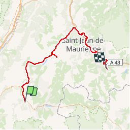

Length
106 km

Max alt
2069 m

Uphill gradient
3578 m
Km-Effort
151 km

Min alt
461 m

Downhill gradient
2768 m
Boucle
No
Creation date :
2019-07-20 05:36:07.047
Updated on :
2019-07-23 20:43:08.508
7h34
Difficulty : Difficult

FREE GPS app for hiking
 SityTrail
IGN / Geographical institutes
SityTrail Plus
The world is yours!
About
Trail Road bike of 106 km to be discovered at Auvergne-Rhône-Alpes, Isère, Le Bourg-d'Oisans. This trail is proposed by PhilippeC54.
Positioning
Country:
France
Region :
Auvergne-Rhône-Alpes
Department/Province :
Isère
Municipality :
Le Bourg-d'Oisans
Location:
Unknown
Start:(Dec)
Start:(UTM)
266105 ; 4993548 (32T) N.
Comments